The Voordelta is a large area of coastal waters within the Dutch North Sea coastal region. It extends from Rotterdam in the north up to the Westerschelde estuary in the south. The quality and abundance of flora and fauna in the area is remarkably high. The Voordelta management system is an early example of integrated and spatial planning taking in account economical as well environmental actors. Paper first written in March 2005, not all information is current. Please read the note at the bottom of this page regarding the new situation The Voordelta is alive again! As of January 29, 2007 a new Voordelta Management Plan is in public information / consultation. More information can be found on the Rijkswaterstaat Voordelta website (Dutch).
Following the completion (in 1986) and the official inauguration by Queen Beatrix of the Oosterscheldekering storm surge barrier in the mouth of the Eastern Scheldt the Delta Project was officially declared to be completed. After a mere 25 years of planning and construction the vulnerable delta, the most southern part of the Dutch coastline, was decreased in length by 800 km and large areas of the country that were formerly only accessible over water were now connected to the mainland by a series of roads constructed on top of the barrier dams. The remaining coastline towards to North Sea spans only around a 100 km. The Delta Project in its final form resulted in the closure of three major estuaries of the Rhine river. Doing so has rapidly created large-scale morphological and related ecological changes and adaptations (which started as soon as the Delta Project started closing the "gaps" with in 1961 the Veerse Gat and from 1970 the onwards the remaining "larger gaps" of the Haringvliet, the Grevelingen and finally the partial closure of the Eastern Scheldt (Withagen, 2000 Withagen, L., 2000. Delta 2000: Inventarisatie huidige situatie Deltawateren. RIKZ, Min van Verkeer en Waterstaat, Directie Noordzee, Rijswijk. (Dutch).) to the new hydrodynamics in the North Sea area in front of the barriers, sluices and dune ridges. Since then a greatly modified morphological system with large similarities to the south part of the Dutch Wadden Sea has been formed. The area is bordered by the 20 metres isobath on sea (within the 12-mile Dutch Territorial zone), and the inner limit of the sea defences on the landwards side. It compromises about 900 km2 of the former overlapping ebb-tidal delta complex and adjacent beaches and dunes (Alphen, 1995 Alphen, J. van, 1995. The Voordelta integrated policy plan: administrative aspects of coastal zone management in the Netherlands. Ocean & Coastal Management 26: 133-155.).

Another important influence on the morphological system in the same region has been the construction of the Maasvlakte near Rotterdam Mainport on the northern side of the delta region. The Maasvlakte, as build as a "bulge" on the coastline outwards to sea, has had a big influence in way of accretion and modification of the coastal sand flow. Morphological changes from to the two projects are now slowing down and considered to be mostly settled, resulting in new changes only originating from other, external, evens as changes in sea level and new developments (the extension of the Maasvlakte, the Schiphol on Sea airport island and possible other "land creating" developments in the sea). The landscape of this area is one that varies from large parts of open sea to Wadden Sea like intertidal areas with sand banks, mudflats and salt marches, to beach and dune systems.
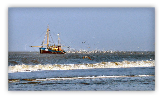
Asides of the expected, but at the time not fully understood, changes in the ecological and morphological system the opening up (by means of the greatly improved road system) of the area created a spur of economical developments not planned nor thought of when the Delta Plan was first created; in its original form the Delta Plan was simply a plan to provide coastal defence, not social and / or economic development. These developments have greatly increased the stress human activities have on the area. Human activities are mainly related to tourism, recreation and fisheries. In the wider region an increase in industry, transport (shipping to the port of Rotterdam as well as the Belgium ports and also based traffic) and urbanisation occurred. These also have an effect on the region. At the same time the ecological quality of the area is increased in importance due to the new habitats and related ecosystems that have been formed (Alphen & Molendijk, 1993 Alphen, J. van, & Molendijk, R, (editors)., 1993. Vorm in Verandering: Integraal Beleidsplan Voordelta. Ministerie van Verkeer en Waterstaat, Directie Noordzee. (Dutch).). Within / between all these activities, including the vision of seeing the environmental resources as a valuable user function, a lot of conflicts existed; closed flatfish nurseries versus fisheries, sea based wind turbines versus shipping etc. To tackle this the Dutch government announced the wish (in its fourth national report on physical planning; the Vierde Nota Ruimtelijke Ordening, 1988 Ministerie van VROM., 1988. Vierde Nota Ruimtelijke Ordening. (Dutch). and again in the Vierde Nota Ruimtelijke Ordening Extra, 1991 Ministerie van VROM., 1991. Vierde nota over de ruimtelijke ordening extra, deel 4: Planologische Kernbeslissing nationaal ruimtelijk beleid. (Dutch).) in 1988 to develop an integral policy for the area, now formally called the Voordelta. This wish solely came from the national government itself as local communities, the provinces, fisheries, recreation and other stakeholders did not ask for this (Jones, 1998 Jones, S.D.R., 1998. A Comparative Analysis of Coastal Zone Management in England and the Netherlands. University of Hull, England.). The policy has been developed to safeguard the continuous development of nature in the area, and to specify how fisheries and recreational activities can be placed into this (Alphen & Molendijk, 1993).
Formal preparation of the Voordelta policy plan (Vorm in Verandering: Integraal Beleidsplan Voordelta, 1993) (IBV) began in 1989 with the formation of the steering group Bestuurlijk Overleg Voordelta (BOV) lead by the North Sea Directorate of Rijkswaterstaat (RWS), the executing body of the Ministry of Transport, Public Works and Water Management (Ministerie van Verkeer en Waterstaat). Aim of this group, which consisted of policy makers and authorities (the four government departments dealing with the Voordelta, and two provincial authorities, and a multitude of authorities from municipalities and waterboards, 30 members in total) was to create a policy plan that via an integrated approach made sure all interest in the Voordelta where covered by the management scheme (Jones, 1998). Advising the BOV was the Ambtelijk Overleg Voordelta (AOV), a committee of officers and staff members from the ministries, Rijkswaterstaat and provinces. Detailed planning of the plan (the actual writing and preparation of the plan) was performed by the Projectgroep Voordelta, this group did not have representatives from the municipalities (Alphen, 1995). Interest groups (conservation NGOs, fisheries organisations etc) as well as all other non-governmental stakeholders were left out of the formal decision making framework and had to rely on informal contacts with the members of the various steering groups (so called Action Centred Networks or ACNs) for each sector (key sectors being: Nature and Natural Development, Fisheries and, Recreation) that had been formed to get their point of view across. Both fisheries and the recreation sector have been in opposition to the structure and aim of the IBV as soon as it was initially described in the Vierde Nota Ruimtelijke Ordening in 1988. Their common argument has been that the structure and its aim as described in the Vierde Nota Ruimtelijke Ordening seemed unnecessary and was bound to create restrictions for both sectors (Alphen, 1995).
In June 1991 a draft plan, the Preferred Policy Option or PPO, was published for public consultation. Key points in this plan were the closure (for recreation and fisheries) of sensitive areas as shoals and tidal flats, as well as the removal of recreation facilities near these areas. New recreational facilities were to be developed in / near non-sensitive areas. Along with the PPO an alternative policy plan (from the three that were made), the Nature Policy Option or NPO was also published. These two plans were both considered to be suitable to the management aim described in the Vierde Nota Ruimtelijke Ordening three years before: to conserve the natural development of the Voordelta, as well as to the finer criteria set up by the BOV (Sideway & Voet, 1993 Sideway, R., & Voet, H. van der, 1993. Getting on Speaking Terms: Resolving conflicts between recreation and nature in coastal zone areas of the Netherlands a literature study and case study analysis. Rapport 26. Werkgroep Recreatie van de Landbouwuniversiteit Wageningen, Ministerie van Landbouw en Visserij, The Hague.). As the PPO option took in account the needs of the recreation and fisheries (defined by the BOV as key for the area, being second in importance to Nature and Natural Development) and within its framework enabled both to develop further locally, the NPO option was more conservative in nature and, although not completely outlawing, limited the fisheries and recreation much more as the PPO did (Jones, 1998).
The moment the draft plan was published for consultation a large number of comments from the well-established conservation NGOs, the recreation sector and the fisheries sector aroused. Conservation NGOs were worried that in the long term policy and management aims in the PPO focused on nature conservation and natural development would be loosened up and compromised to make way for more development and opposed the PPO in favour of the NPO option (Sideway & Voet, 1993). Recreation and fisheries (and with them most of the local municipalities) on the other hand were mostly happy with the PPO option as it underlined most of their expectations for the management of the Voordelta. The conservation groups as well as some scientists successfully raised the topic of the quality of information and scientific data on the impacts of recreation on wildlife -mostly wading birds, porpoise and seals. Large parts of the Voordelta are now assigned under the EU Bird- & Habitat Directive (Bird area assigned in 2000, habitat directive formerly implemented in 2008) and Natura 2000 network as well as the area being a Ramsar wetland site- and lobbied in favour of a more precautionary approach to nature conservation, closing large areas of the Voordelta for fisheries and recreation. Questions were raised if seals for example needed disturbance distance zones of 500, 1000 or 1500 (as in the Dutch Wadden Sea area) metres. The particular question of the seal disturbance zones was questioned by recreational groups. As consultation went on, strong lobby of the conservation NGOs forced the BOV to redesign its criteria to ultimately assure more room and/or focus for nature conservation (Sideway & Voet, 1993).
The second draft of the plan, the draft policy plan, was published in May 1992. While maintaining the aims and objectives of the PPO the details of the individual proposals were implementing much more restrictions on fisheries (the full and year round closure of shoals and shallows of less then six meter below mean sea level) and access and development for recreation. These extra restrictions were put in place to comply with the new, more focussed on conservation, criteria put into place by the BOV due to the strong lobbying of the conservationists (Sideway & Voet, 1993). This draft plan had to be submitted for approval by the various organisations participating in the steering group. During this process, that ultimately took more then a year, lobbying stirred up again and one of the participants (the municipality of Westvoorne) withdrew from the entire process because of the strong public disagreement in the municipality on a proposal to close one of its beaches for motor vehicle access (Jones, 1998). The final version of the plan and its formal implementation was signed by the members of the BOV in October 1993. The Integraal Beleidsplan Voordelta includes descriptions of the policies and measures, the ultimate aims of the policy plan and a spatial translation of the policies and measures into a zonation scheme to allow a quick assessment of the management of various areas of the Voordelta and the level of environmental protection in the various areas (Alphen, 1995).
After 1993 the IBV has not been formally revised or updated. As it has a non-legal status an Administrative Agreement has been signed by all parties involved in the BOV in which the various administrations expressed their intention to incorporate the IBV and the 47 points of its action programme into their legal planning instruments. Main legislation to implement are the EU Birds and Habitat Directive, the Nature Conservation Act and the Fisheries Act. According to Alphen, 1995, this process was started roughly a year after the signing of the agreement. The Voordelta Newsletter 15/16 (December 1999), including an article describing the outcome of the Voordelta Evaluation, however states the plan has low priority with the people responsible for executing it. Implementation and executing of the policy plan is taking place on a snail's pace. Key reasons for this sluggishness seem to be the delay in the proper implementation of the Natuurbescherminswet (the Nature Conservation Act) and the vagueness around the extension of the Maasvlakte. A third delay still relevant at this moment in time seems to be caused by the problems with the Vijfde Nota Ruimtelijke Ordening (the fifth national report on physical and spatial planning), the following abandoning of this (not implemented) spatial management plan and the development of the Nota Ruimte which, when implemented, will be successor of the Vierde Nota Ruimtelijke Ordening Extra.
Although some problems and issues -mostly regarding a number of fish stocks- are still apparent in the area it seems that most of the wider conservation aims of the IBV have been accomplished by now. The Voordelta is a healthy system with great value for nature, recreation and fisheries (in that order). A number of SPAs / SACs have been put into place and by 2000 all of them had received proper management plans (Withagen, 2000). After 1998 / 1999 it seems that interest in the policy making and management process has come down a bit and the Voordelta has taken in a for granted place in the area. The last Voordelta Newsletter was published in 2000 and overall focus of "what direction to take with the Voordelta" seems to have shifted towards the newer, legal, planning instruments and more important to the Maasvlakte extension and the related nature compensation in the Voordelta area. Of the 47 actions in the original policy plan only seven (and two where close to being realised) had been realised in 1999 (Voordelta Nieuwsbrief 15/16, 1999 Centraal Informatiepunt Voordelta., 1999. Werken aan een nieuwe impuls. Voordelta Nieuwsbrief 15/16. Rijkwaterstaat, Directie Noordzee, Rijswijk. (Dutch).). The current consultation & managing body (the Stuurgroep Voordelta) of the Voordelta has decided in 1999 and again in 2002 to reassess the list of actions in the IBV. Also it was decided to rethink the way interest groups are involved in the further implementation and execution of the IBV. It is not clear what the outcome of these two goals were.
The delay in implementing the Nature Conservation Act in the Voordelta seemed to be mostly related to the difficulties around the Project Mainportdevelopment Rotterdam (the extension of the Maasvlakte or Maasvlakte-II). Already in 1991, with the Vierde Nota Ruimtelijke Ordening Extra it was acknowledged that the entire Voordelta (which includes the Maasvlakte area) should be managed according to the "green direction". Though that it was in the economies best interest to pursue the "blue direction" in the small part of the Voordelta covered by the Maasvlakte area. The blue direction offers more opportunities for economical development and a lesser focus on nature conservation. In June 1999 the Dutch parliament formally acknowledged the need for more space in Rotterdam Mainport by agreeing on the interim report Project Mainport on Track. In 2004 the formal decision was taken by the Dutch parliament, the province of South-Holland and the city of Rotterdam to extend the Maasvlakte with a first 500 ha. The now planned size of the harbour and industrial area will be around 1000 ha with a total influenced and changed planning zone (loss of seabed) of 3123 ha (Brouwer & Tempel, 2001 Brouwer, H., & Tempel, R. van der, (editors)., 2001. Advies over natuurcompensatie bij een tweede Maasvlakte; Advies ten behoeve van PKB-plus deel 3 en de adviesaanvraag bij de Europese Commissie. Expertisecentrum PMR, Rotterdam. (Dutch).). As this leads to a loss of protected environment (see above, among other things it is assigned as a special bird area, part of the Natura 2000 network) nature compensation on sea had to be found in order to comply with the Natura 2000 goal of "maintaining the structural integrity of the network".
Although a number of alternatives was considered, the idea of having a "sea reserve" or "marine reserve" (a term without any legal definition, merely used to indicate that the proposed nature compensation offers a higher level of protection than the already existing conservation means in the area) within the Voordelta was seen as a structural part of any of the alternatives (Brouwer & Tempel, 2001). As the Voordelta already favours a fairly high level of protection, and the natural values are high compared to the compensation needed it is calculated that adding the extra level of protection the declaration as "sea reserve" can offer is only about ten percent. This basically means that for every hectare of lost seabed ten times as much compensation is needed. An area of 31.230 ha (the total influenced and changed planning zone times ten) will be large enough to accommodate slow moving animals as crabs, lobster and snails. To provide a proper reserve for fish as ray (larger animals, but still not moving over large distances) the area is too small (Lindeboom et al, 2001 Lindeboom, H., et al., 2001. Een zeereservaat in de Voordelta als compensatie voor Maasvlakte 2. Alterra, Texel. (Dutch).). Management changes to upgrade part of the Voordelta to a sea reserve will basically mean a complete and year-round closure of about one third of the area to all disturbing activities, including fisheries, recreational boating and (military-) flights. The full area (the seabed) will be closed for fisheries and other bottom disturbing activities. Three areas within the Voordelta were deemed suitable for implementing of a sea reserve. Ultimately the location in front of the Haringvliet has been selected as most suitable as it will provide a large increase in shellfish (cockles an mussels) used by birds to feed on, and will also provide valuable nursery grounds for certain species of fish. This is also the option that least affects fisheries and may even have a positive effect on the middle to longer term in providing overspill (Brouwer & Tempel, 2001). Currently the Management Plan Sea Reserve is being finalised by Rijkswaterstaat and the Projectgroup Mainport Rotterdam. It is expected to be ready for public consultation in September 2006. To achieve its aim of implementing the nature compensation before starting with the construction of the Maasvlakte (second half of 2007) the national government wants to implement the management plan in the first half of 2007 latest. The shape and management scheme of the Sea Reserve will not have a fixed status. As the amount of protected ecology and habitat to be lost due to the Maasvlakte extension is currently unknown (government sponsored monitoring and counting projects are currently in progress) it is possible that changes are made during an evaluation moment somewhere in the next couple of years (Brouwer & Tempel, 2001).
After a little over a decade since the implementation of the IBV it seems apparent that things are, and have been, moving in the right direction. As the implementation of the constructions laid out in the Delta Act of 1958 basically created a new habitat and related ecosystem within the Voordelta area the IBV tried to support this development when the period of hard structural engineering of the delta works was over. A process that already started with the protests against a fully closed Eastern Scheldt (and resulted in the beautifully deformed monster; the Oosterscheldekering) it became clear with the IBV that a different way of coastal management and thinking about the coast had entered the policy making process. Had the traditional thinking of Rijkswaterstaat and the various ministries always been one of protecting the coastline against threats from the sea, the new way of thinking was one of fitting the sea and the sea-region into spatial planning. Now government would not only construct defensive systems to protect against the water but would also construct facilities (legislative as well as real world) for various uses as recreation, fisheries and nature conservation.
Science shows that the nature (the single most important "management interest" in the policy area, the IBV being an integrated plan there is just interaction with the other interests as recreation and fisheries though) in the area has developed well during the last decades and is an important contribution to the Dutch marine nature. This should of course be seen in a critical view as in a way the Voordelta area as a whole can be seen as some kind of natural nature compensation created to compensate for the loss of similar areas due to the construction of the delta barriers and the resulting closure of some of the estuaries. The creation of the Maasvlakte extension will put extra stress on the area. It's still to be seen what exact influence this will have on the habitat and ecology. The Voordelta Sea Reserve compensation will hopefully add to the resilience of the area as a whole as it will create a fully closed area. An area safeguarded from most (although a large oil spill will be quite hard to keep out) external disturbances by its strong ecological structure.
Although the extension of the Maasvlakte and the connected sea reserve is currently the hottest issue in the Voordelta a number of other issues and opportunities are also playing at this moment. For as long as the IBV existed the beach with motor vehicle access in Westvoorne has been a hot topic locally as well as one disturbing consultation in IBV process as a whole. As recently the beach was finally closed for motor vehicle access the discussion has entered a new state of passionate debate in where even politicians from the province seem to become involved. A second issue is the possible placement of a near shore wind farm. This debate has just been started but might end up to be an interesting one as new policy seems to have openings for the creation of a park in the Voordelta area. A third, and for many people (mostly older people who remember the 1953 disaster), painful topic is the further "breaching" of the fixed sea line by creating fresh water / salt water transition zones to facilitate nature development with possible benefits for fisheries and recreation in some of the estuaries. It will be interesting to see how the Voordelta is doing in the upcoming years in lights of the implementation of new legislation as the Nota Ruimte Ministerie van VROM, Ministerie van LNV, Ministerie van Verkeer en Waterstaat, Ministerie van Economische Zaken., 2004. Nota Ruimte; Ruimte voor Ontwikkeling. (Dutch). (which, among other changes, includes a call for decentralisation where possible) and the IBN2015 Rijksinstituut voor Kust en Zee., 2002. Naar integraal kustzonebeleid; Beleidsagenda voor de kust. Ministerie van Verkeer en Waterstaat, Rijkswaterstaat. (Dutch)., the positive or/and negative results of the sea reserve on the nature, recreation and fisheries, and the possible implementation of fresh water / salt water transition zones in the Eastern Scheldt and other estuaries. With a continuous focus on integrated planning and maybe with a better involvement of local, non administrative, stakeholders (as an example of the current relation; the Dutch association of fisherman still refuses to give out recent statistics on fisheries they collect as they do not completely trust the policy makers) the IBV or the new version of it should be able to work fairly smoothly for the next couple of years.